Between Angers, Nantes and Cholet

Ôsez Mauges – Uk Ôsez Mauges – Uk Ôsez Mauges – Uk

  • Our essential Open Previous
      • Wineries and views
      • In the air
      • Boat tour
      • Gardens
      • Culinary specialities
      • Guinguettes
      • The most beautiful views
      • Our markets
  • Plan your trip Open Previous
      • Accommodation
      • Eating out
      • Ours Local producers
      • Our tourist attractions
      • Our boats
      • Hiking trails
      • What to do now or later?
      • La Loire à Vélo
  • Getting here and getting around
  • Contact us
  • en
    • fr-fr

Contact us

Ticketing

Go to bookmarks lists 0

I search

Menu
Home Plan your trip Hiking trails Randonnée “La Boulinière”

Randonnée “La Boulinière”

Itinéraire, La Jumellière

Randonnée “La Boulinière”

Distance : 5.46 km
Distance : 5.46 km
Départ : LA JUMELLIÈRE
BLEU
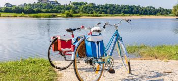
Randonnée de la Boulinière à la Jumellière.
Randonnée “La Boulinière”

Petite boucle familiale de 5.5 km aux abords de la Jumellière.

Get to the starting point

Report a problem

Previous route

Back to the list

Next route

Full screen Close
Download :
  • pdf
  • gpx
Close

Ôsez Mauges Tourisme et développement

1 Rue Robert Schuman - La Loge
CS 60111 - BEAUPREAU
49600 BEAUPREAU EN MAUGES

Tél. : 02 41 72 62 32

Contact us How come?

Newsletter

Subscribe to the newsletter to learn all about the latest news

Subscribe

Follow us
  • Follow us on Facebook
  • Follow us on Instagram
  • Follow us on Youtube
  • Follow us on Twitter
  • Follow us on Pinterest
  • Interactive map

Site map - Legal information - Edit my cookies - Privacy Policy - Conditions générales et particulières de vente - Made with by IRIS Interactive

This website is protected by reCAPTCHA. The confidentiality rules and Google conditions of use Apply.

Up

Close

Select your language

[google-translator]